Providing subsurface imaging solutions with non-destructive and eco-friendly technology
Ground Penetrating Radar
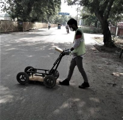
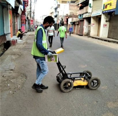
Ground Penetrating Radar (GPR) is a geophysical technique that is widely used to study the shallow subsurface in a broad range of applications and environmental settings. GPR is a non-destructive and non-invasive geophysical method that uses radar pulses to image the subsurface and detect reflected signals from subsurface structures. GPR is widely used to locate underground utilities in the civil engineering and construction industries. It provides accurate mapping of existing underground utilities with real time visualization which provides immediate answers to facilitate efficient decision making.


GPR Principles
GPR uses short impulses of high frequency radio waves directed into the ground to acquire information about the subsurface. When the waves hits the buried object or a boundary with different dielectric constants, the receiving antenna records the variations in the reflected return signal. The depth and resolution that can be achieved with GPR depends on the frequency of the transmitted electromagnetic pulse. A higher frequency results in higher data resolution, whilst a lower frequency results in better depth penetration.
GPR Applications
GPR plays an excellent role to the determination of the exact location of existing underground facilities. It can be used for various constructions and planning projects which requires accurate information on underground utilities.
GPR is an advanced tool for imaging the runway's subsurface structure to identify areas of potential voidness and other structural concerns. GPR can provide information about where subsurface structures are changing. It is an accurate and cost-effective tool for pavement structure analysis.
GPR is totally a non-destructive technique to produce a cross section profile of subsurface without any drilling, trenching or ground disturbances. Ground penetrating radar (GPR) profiles are used for evaluating the location and depth of buried objects and to investigate the presence and continuity of natural subsurface conditions and features.
GPR is the noninvasive sensing technique, making it possible to investigate higher volumes without affecting the structure. This technology, making it possible to investigate higher volumes without affecting the structure. It is praised as the fastest, most non-destructive option in inspection and analysis of bridge decks.